Eyjafjallajökull — The 2010 Eruption
The volcano that grounded European aviation for six days and captivated the world
Eyjafjallajökull is an ice-capped stratovolcano on Iceland's south coast that became globally famous in 2010 when its eruption produced an ash cloud that disrupted air travel across Europe for weeks. The name means 'Island Mountain Glacier,' referring to the Westman Islands visible offshore. Beneath its serene ice cap lies one of Iceland's most historically significant volcanic systems.
The 2010 Eruption — Two Phases
Phase 1 — March 20, 2010: The initial eruption began on the Fimmvörðuháls flank, creating spectacular lava fountains visible from across the south coast. This effusive eruption attracted thousands of tourists to watch lava flows lighting up the night sky for three weeks.
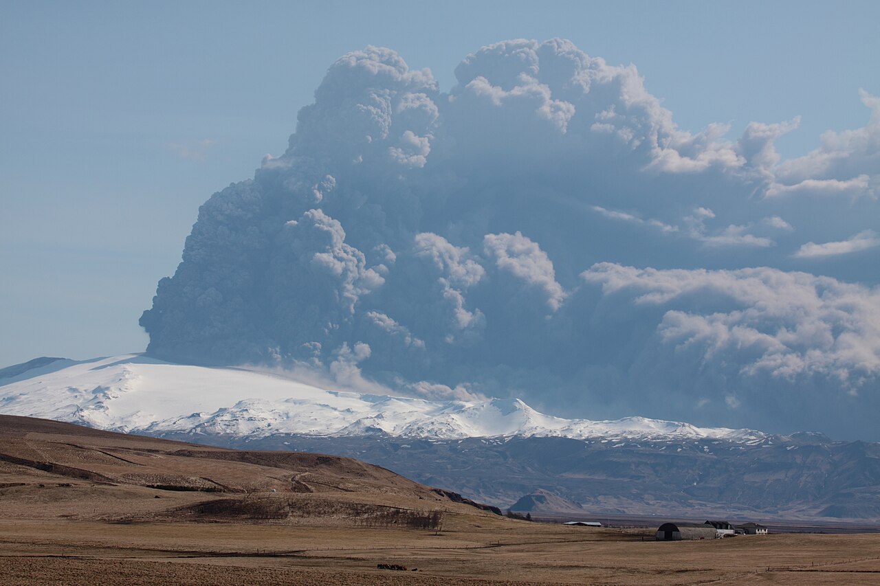
Phase 2 — April 14, 2010: The main explosive eruption began under the ice cap, creating massive ash clouds that rose 11 km into the atmosphere. The interaction between magma and meltwater created extremely fine ash particles that were catastrophic for jet engines. European airspace closed for 6 days.
Global Aviation Impact
- 100,000+ flights cancelled across Europe
- 10 million passengers stranded
- $1.7 billion in economic losses
- Worst aviation disruption since World War II
- Ash cloud visible from space
- Eruption continued for weeks
Why Was the Ash So Dangerous?
The interaction between Eyjafjallajökull's magma and the overlying ice cap created an unusually fine-grained volcanic ash. These tiny particles — far smaller than those from lava-only eruptions — can melt inside jet engines, forming a glass coating that causes catastrophic failure.
Westerly winds carried the ash cloud across Europe at altitude, creating invisible hazards for aircraft across the entire continent.
Viewpoints & Visiting
- Ring Road: Multiple viewing spots along the south coast
- Þórsmörk: Scenic valley at the base of the volcano with day hikes
- Seljavallalaug: Historic pool with volcano backdrop
- Skógafoss: Waterfall with Eyjafjallajökull as a dramatic backdrop
- Fimmvörðuháls trail: Passes the 2010 craters — challenging, experienced hikers only
- LAVA Centre in Hvolsvöllur: Interactive exhibition about the 2010 eruption
Safety Information
Eyjafjallajökull is an active volcano monitored continuously. Do not hike on the ice cap without a certified glacier guide. Check vedur.is before planning visits to the highland areas.